Leica Geosystems part of Hexagon
Engineering @ Leica Geosystems part of Hexagon
Du möchtest mehr darüber erfahren, wie das Ingenieurwesen bei Leica Geosystems gelebt wird? Nimm an unseren virtuellen Vorträgen aus den unterschiedlichsten Bereichen teil und erhalte exklusive Einblicke in die Welt der Vermessung und Informationserfassung.
Du kannst dich für jeden Vortrag unter dem angegebenen Link registrieren. Unsere Ingenieure stehen dir anschliessend für Fragen zur Verfügung. Wir freuen uns auf einen spannenden Austausch!
Evolution of civil engineering through machine control innovations
Uhrzeit: 11:00 Uhr bis 12:00 Uhr
Civil engineering has been transforming our lives for decades. But how has technology transformed civil engineering into what it is today? Learn how machine control has shaped the heavy construction workflows and how different Leica Geosystems’ solutions contribute to tomorrow's infrastructure.
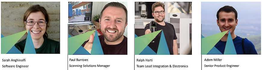
Redner: Sarah Anghinolfi, Software Engineer
Sprache: English
Digital construction in the age of Reality Capture
Uhrzeit: 13:00 Uhr bis 14:00 Uhr
Learn how the latest scanning and imaging solutions from Leica/Hexagon Geosystems provide actionable data in all your construction projects. Having relevant, up to date digital twins enables decisions to be made faster on site, and also to help reduce risk and losses. Data can be compared in the field in near real-time or in the office as required. All the deviations and issues can be digitally tracked to ensure all project stake-holders are kept informed. This is the new age of digital construction powered by reality capture data!
Redner: Paul Burrows, Scanning Solutions Manager
Sprache: English
Reality Capture für Alle
Uhrzeit: 16:00 Uhr bis 17:00 Uhr
Reality Capture muss nicht kompliziert sein.
Moderne Scanner sind einfach in der Bedienung und ermöglichen dennoch eine genaue Datenerfassung. Wir sehen uns gemeinsam an, wie Leica Geosystems Reality Capture zu einer "Single Button Experience" gestaltet und damit für alle zugänglich macht.
Redner: Ralph Harti, Team Lead Integration & Electronics
Sprache: Deutsch
Inside the world's largest GNSS correction service
Uhrzeit: 17:00 Uhr bis 18:00 Uhr
Global Navigation Satellite System (GNSS) correction services, such as HxGN SmartNet, were traditionally only used by positioning experts in the surveying industry. Today, these services are available to everyone and are, for example, frequently used in agriculture and construction industries for automated machine positioning. Users working in such industries now rely on HxGN SmartNet to enable GNSS positioning to the centimetre level - 24 hours a day, 7 days a week.
Learn how HxGN SmartNet meets the demands of customers, to reliably operate the world's largest reference station network.
Redner: Adam Miller, Senior Product Engineer
Sprache: Englisch
Möchtest du mehr über deine Karrieremöglichkeiten bei uns als Ingenieur erfahren? Dann schau vorbei unter
https://leica-geosystems.com/about-us/careers/explore
Donnerstag, 04.03.2021
11:00 - 18:00
Vier Virtuelle Vorträge
Heinrich-Wild-Strasse
9435 Heerbrugg
Emilija Minova
Organisator